- California-Nevada Chapter of the Oregon California Trails Association
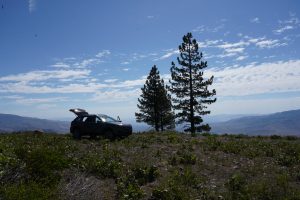
- Dog Valley
- Sierra College, Henness Pass Road
- Blogging about Dog Valley
Henness Pass Road
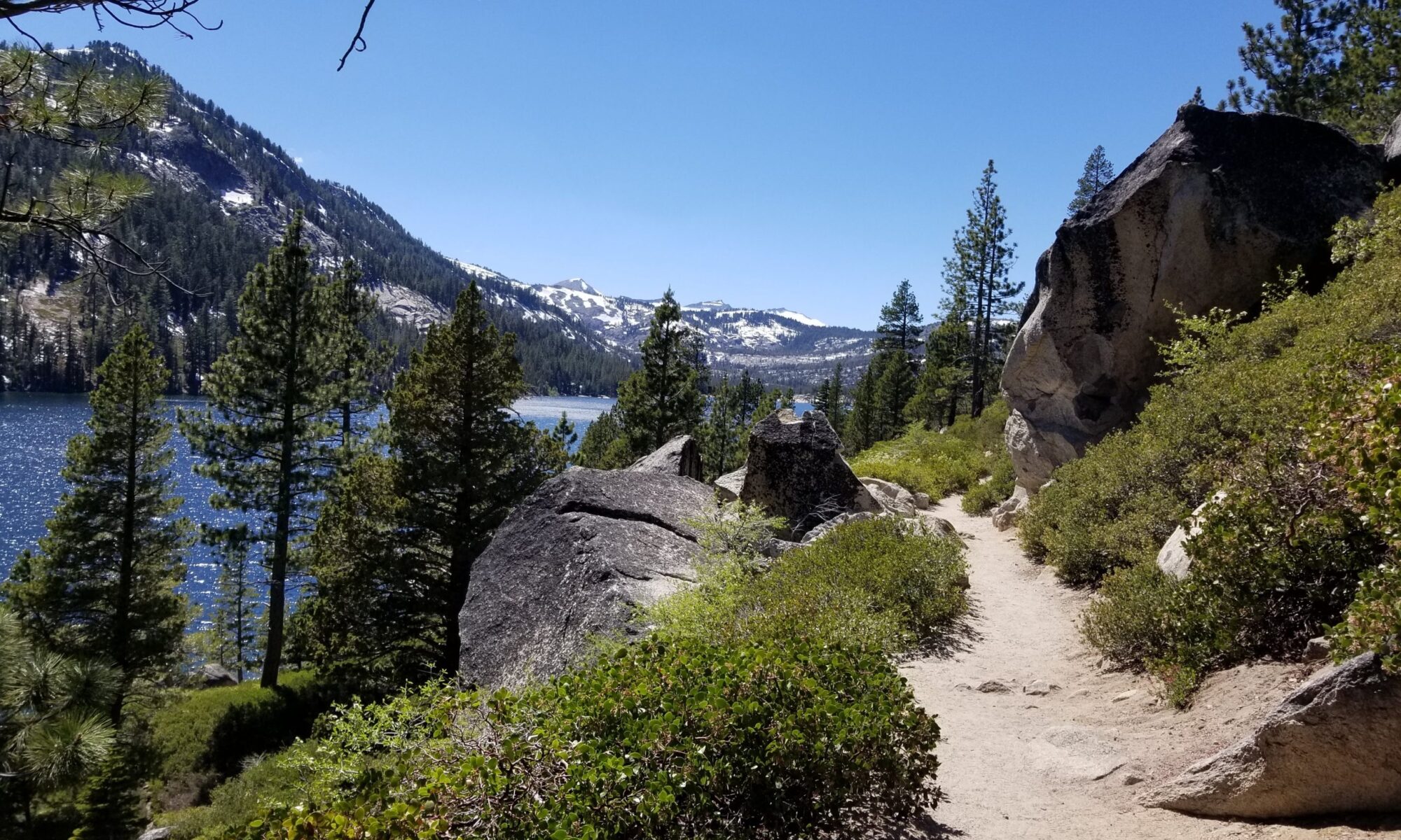
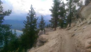
 Steeped in the history of the old west, Henness Pass Road provides a more scenic and relaxed route through the Sierra Nevada Mountains. Originally the indigenous tribes of North America used this as a major trade route. This secluded and winding mountain road extends for over 100 miles. It travels through scenic mountain passes and vistas. A lot of it is recommended for high clearance, four-wheel drive vehicles. In addition to the scenic views, travelers will find waterfalls, rustic inns such as the Mountain House Stage Stop and Inn, abandoned mining camps, abandoned mines and numerous historic sites from the Gold Rush.
 History
Henness Pass Road was the primary emigrant trail from Virginia City, Nevada as early as 1849 and the only mountain pass that existed at the time. During the Gold Rush, this often forgotten highway served as a supply road for the Comstock silver mines in Nevada. In 1852, Henness Pass Road was a wagon toll road from Nevada to the gold field of California. Between 1860 and 1868, traffic was so heavy at times, that freight wagons had to travel by day and stagecoaches drove at night. Once the transcontinental railway was completed in 1868, the road was abandoned. Fortunately the road is still there and has been left to the more adventures among us.
Views
Henness Pass Road passes Sardine House and a 1,500 acre ranch that once stood in Sardine Valley. Weber Falls is at the top of a 25 foot pool that plunges into a waterfall of nearly 80 feet. Jackson Meadows Reservoir marks the halfway point. Henness Pass Road traverses the Middle Fork of the Yuba River, travels along the open pine forests and meadows above the Little Truckee River. In many places, the creeks wash over the road. This pass is the lowest pass through the Sierra.
Traveling
From the East the road begins in Verdi Nevada, Old Dog Valley Road. then travels West over Henness Pass then drops down to the Middle fork of the Yuba River. The road terminates at Camptonville California on highway 49.
Henness Pass, California 96126, USA
Ladybug Peak, Verdi Range, California
 The Verdi Range
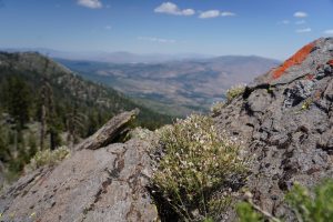
Ladybug Peak in the Verdi range, California at 8,380′ is one of the two tallest peaks in the Verdi range. They are located just across the Nevada/California border west of Verdi, Nevada. This range is desert like on the east side, and forested on the west side. And is an example of how the mountain ranges in this area act as a rain shadow. Views east reveal a desert landscape, and views west show a forested landscape.
See Links page to learn more.
 In The Sierras
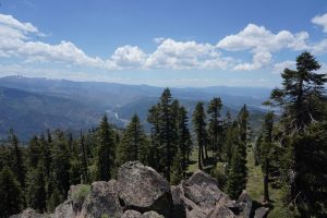
The Verdi Range, which covers about 12 miles north-south. It’s southern terminus is at I-80, it’s northern terminus at Henness Pass. The range is just north of the Carson Range, and is part of the northern Sierra Nevada Mountains. Not as tall as their southern counterparts, this range still rises up precipitously from the valley floor.
The two summits are located about a mile from each other and share a saddle at about 8,055′. They are both reached from the same approaches. These primary approaches are from the north side or northwest side near the Stampede Reservoir. Roads lead up to just below the summit of Verdi Peak, and within 250 yards of the summit of Ladybug Peak. So, a 4WD can get you really close to these summits. Without 4WD, the closest you can get is a little under 5 1/2 miles from Verdi Peak.
Getting There
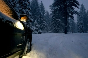
There is temptation to approach Verdi and Ladybug Peaks from the east side. Especially for those living in the Truckee Meadows area. Verdi is nearly 30 minutes closer to Reno/Sparks than the Stampede Reservoir. And there is a way to reach these peaks from the east, without crossing private lands, or at least without crossing lands with restricted access. However, to do so is brutally tough due to the thick brush and rocky four wheel drive roads on the east side. Because of the very steep, trail-less, route-less, eastern approach hiking it is not recommended. Although, in winter, it would be interesting to try this with snowshoes.
These peaks can be climbed year-round. Although typically they are snow covered from late-November through late-April-mid-May. The road to Stampede is closed if snow conditions warrant. Views are excellent, with mountains on all sides. Fall is probably the best time to hike here, or late spring if snow levels are adequately low.
Verdi Range Links Page
Here are some interesting links to the Verdi Range
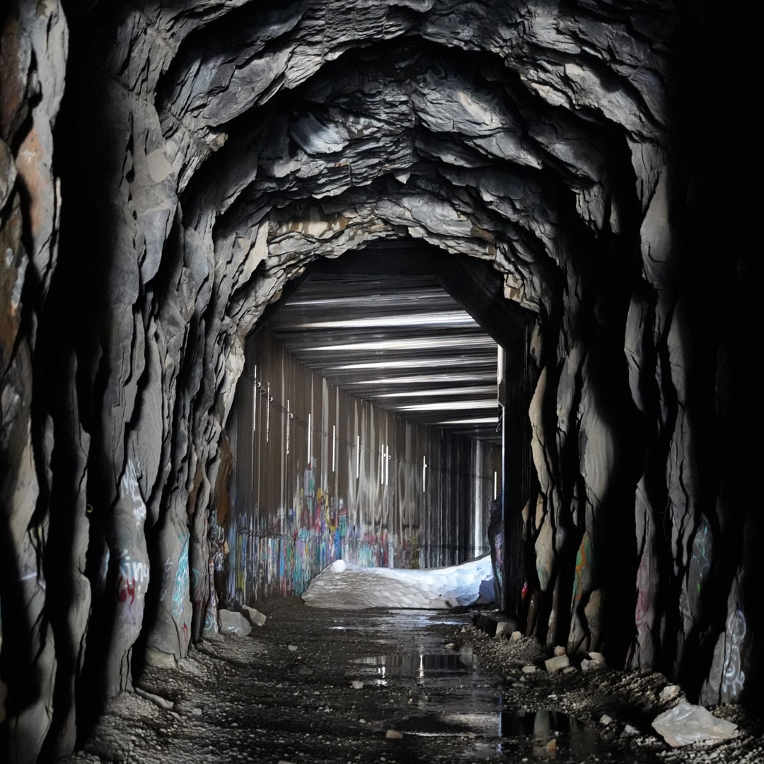
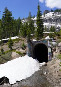
The Donner Pass Railroad Tunnels
Endangered History
 SFgate Article on The Donner Pass Railroad Tunnels
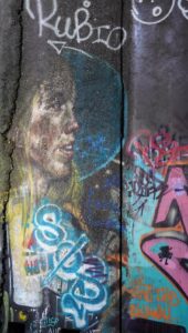
The Donner Pass Railroad Tunnels have long been an attraction for hikers, history buffs, artists and vandals. They are located in a favored area of local outdoor enthusiasts. For most people the tunnels were an obscure curiosity. But thanks to COVID and an increased interest in exploring our world, this area has become much more popular.
The structures and tunnels are over 150 years old. And there are other stories here too, such as the the ancient petroglyphs which are etched into the granite. The stone itself is attractive to rock climbers and hikers. Bicyclists pedal by on the old Lincoln highway, (highway 40), and in the winter this is the backyard to Sugar Bowl, a popular ski resort and the lower gateway to some really great winter back country.
And because of all of this the Donner Pass Railroad Tunnels are being loved to death. Read more here.
This area has a great story to tell. It is a tale of the indigenous people who lived here. The Chinese who played a pivotal and unacknowledged role in our history. And there are abundant local stories of extreme skiing, rock climbing, aeronautics, runners, hikers and bicyclists. From within these diverse populations a community has developed consisting of those who love and protect this part of the sierra.
Please read on and learn more. These stories can save the legacy of this area, and maybe create stewards out of those who would visit.
Verdi Peak, Sentinel of the Truckee Meadows
Verdi Peak
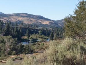
 Verdi Peak and Ladybug Peak provide a beautiful view of Reno and Sierra Nevadas from the California side of the California/Nevada border. The peaks are part of the Verdi range of mountains which span an area North to South of about twelve miles. Verdi Peak is the tallest peak in this small range. The Verdi Range is almost entirely National Park land in the Toiyabe National Forest.
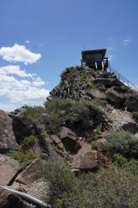 The Verdi Peak fire lookout provides magnificent views of the surrounding area. In winter the range is covered in snow. This makes it a good spot for snow shoeing and winter exploration. During the summer there is Boca and Stampede reservoirs, an abundance of OHV trails and roads to explore. This area is close to the Henness Pass, Crystal Peak and Dog Valley areas. All of which have a lot of historical interest.
To access Verdi Peak it is easiest to
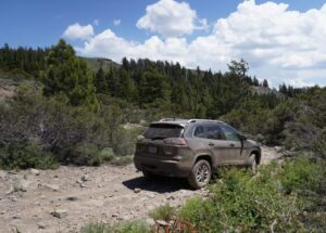
come from the West. The Eastern approaches are much more difficult. This is because the Verdi land owners have blocked most of the Eastern access roads. And hiking the Eastern slope is difficult because of the heavy brush and steep slopes of the eastern side of the range. The western approach is found by the taking the Hirschdale exit from Interstate 80. You will pass the Boca Townsite and Boca Reservoir. Then follow the signs to Verdi Peak. The road up from the paved Stampede Meadows road is a four wheel drive road. It is rocky and quite rough.
There are not a lot of links to information on this area. Below are a few.
Geohack Not sure what this is? Check it out, open source mapping applications for map geeks
The Lake Tahoe, Pyramid Lake Area
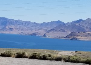 From one of the worlds largest and clearest freshwater lakes to the grandeur of the final remains of a vast inland sea, The Tahoe Pyramid Lake area has something for everyone. Spanning two states, and impacting the entire country, this area is being discovered and rediscovered on a daily basis.
As populations increase and demographics change, the impacts on this highly desirable area are becoming more pronounced. More and more people are moving here, visiting and exploring. It is my belief that when we learn about an area, its history, inhabitants, ecology and geology we become engaged with the land. And when we have an attachment to a place we frequent, we become better stewards.
 So how does this happen?
Humans tell stories. We relate to each other through shared experience. This happens through the written word, verbal language, visual mediums such as UTube, movies, short videos and pictures. Our evolution is entirely dependent on our advances in communication. And we are at a time when great strides are being made in communication. The old is melding with the new. We can share our personal mythology with the world in ways never before imagined. And we can learn in more ways every day.
 What does this have to do with the Lake Tahoe Pyramid Lake Area?
Some time ago I was working within a forest community to help educate them on what could be done to mitigate the dangers of forest fire. Talking is the usual mechanism to do this. An “expert” would stand and talk at the crowd. This, however, is only as effective as the expert. And while the expert knows much about her area of expertise, they likely know very little about another area of expertise, communication. I noticed, over a period of time that maps really bridged the gap between verbal information and the real world. Often this helped highlight the points the expert is trying to make. We are highly visual and spatial creatures. Google has known this for years and has done much to propel the idea of Graphic Information Systems, (GIS), forward.
Watching how maps were a very effective teaching and collaboration tool got me thinking. I have always loved paper maps, and the ever evolving digital map is even more fascinating, (although not necessarily better). I have found that the digital maps are limited. Often resource intensive and they can take a high level of experience and resources to utilize. It seemed like it should be easier. This site is my attempt at doing that.
 Intent
I want to engage people in our communities and environment through the well tested art of story telling. Media and our evolving mapping technologies are an excellent way of doing this. So, this site is meant to be a platform for discovery and contribution. It is the marriage of technologies, old and new. And is an attempt at making it more accessible to all. And without the hidden agendas around collecting personal data and marketing.
The idea is to engage people by sharing the stories of our favorite places. This platform provides a place to share your own histories myths and adventures. It is a pilot project with a focus on the the grand area roughly defined as the Lake Tahoe, Pyramid Lake area.
I know there is more than enough content to keep this resource going for a very long time. And I hope it brings value to your life.
 Show on map